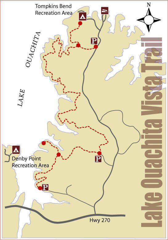
Lake Ouachita Vista Hiking Trail first 4.7-mile segment is open. Plans call for the trail to extend 35 to 40 miles along the Lake Ouachita shore and link up with the Charlton trail.
Directions:
(From the West)
Take Us 270 east from Mt. Ida about 10 miles to Shangri-La Road take a left and go one block to Trail’s End Road and take another left. Go to the end of the road where it terminates at the lakeshore where you will find the southern trailhead parking area.
See The Fishing Tool Set Lake Ouachita Guides Recommend
(From the East)
Take Us 270 west from Hot Springs about 25 miles from last stop light. Turn right onto Shangri-La Rd go one block turn left onto Trail’s End Rd and go to the end of the road where it terminates at the lakeshore. Trailhead is to the left of the Parking lot